

The new ongoing reclamation at Changi East is reflected in the 2019 Draft Master Plan.

Here's a closer look at the reclaimed area from the latest Port Marine Notice by MPA.

According to Urban Transformations>Changi Region: "in the longer-term, a waterfront district could be developed to offer exciting new recreational and tourism possibilities."

Hopefully, these plans can take into consideration the existing rich shores that are already found here. Like the lush seagrass meadows opposite NSRCC that we saw in Feb 2019.

And the seagrass meadows growing at the mouth of a canal next to the Park Connector, seen in May 2018.

There are also seagrasses at the artificial lagoons next to Tanah Merah Ferry Terminal. Here's what we saw in May 2014. We no longer regularly survey this shore as it is closed to the public.

While amazing corals have settled on the seawalls at Tanah Merah Ferry Terminal!
 |
| MORE on Loh Kok Sheng's blog about our May 2014 survey here. |
 |
| Some of the many corals seen by Loh Kok Sheng our May 2014 survey here. |
What is the Master Plan about?
My layman understanding is that the Master Plan, done by the URA, outlines the uses of Singapore's land* to "guide Singapore’s development needs over the next 10 to 15 years". Various Ministries and government agencies are responsible for actual details of how the use is applied. The Master Plan seems to be updated every 5 years or so. Here's the full technical explanation of what the Master Plan is about.
*The URA Master Plan does not outline uses of sea areas (except for reclamation profiles). The need for integrated marine spatial planning is covered under Recommendation 1 of the Singapore Blue Plan 2018: "Establish formal management systems for marine environments. A marine spatial planning regime should be established within the integrated urban coastal management framework". With more details in the section on "Coastal and Marine Spatial Planning" under the Chapter on Legislative Support for The Blue Plan 2018
In addition to browsing through the URA 2019 Draft Master Plan website, I highly recommend visiting the URA's exhibition to get a better feel of the Plan.
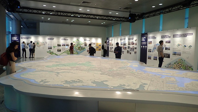 |
| At the exhibition, in addition to informative panels, there is also a show over the large map of Singapore that effectively illustrates the key aspects of the Plan. |
What can one person do about the Draft Master Plan?
Speak up for what you love!
URA is actively seeking YOUR feedback (that's why a Draft is presented first). Send in your ideas and feedback by 25 Apr 2019.
Don't take our shores for granted!
Visit our shores before they are gone. Join nature activities on our shores. Share what you've seen.
To find our more, check out Celebrating Singapore shores
- Connect with our shores by joining shore activities.
- Respect our shores by learning more.
- Protect our shores by volunteering.
Related links to the 2019 Draft Master Plan
- Climate change in the 2019 Draft Master Plan
- Pulau Ubin and northern shores in the 2019 Draft Master Plan
- Kranji and Mandai shores in the 2019 Draft Master Plan
- Eastern shores in the 2019 Draft Master Plan
- Southern shores in the 2019 Draft Master Plan
- Pulau Ubin and northern shores in the Draft Master Plan 2013
- Southern shores in the Draft Master Plan 2013
- Mandai mangroves in the Draft Master Plan 2013
