We survey the seagrasses and shores at Pulau Semakau South on the first of the
evening low tides of the year. Singapore's largest fish farm lies opposite these
shores.
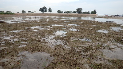
The corals seem alright. Although Tape seagrasses have not returned and vast stretches remain bare of seagrasses, there was good seagrass growths near the landfill wall. It was worrying
to see Horse mussels expanding on the shore.
Just as Changi Airport and Changi Beach are not the same even though they are near one another and share a name, Pulau Semakau is NOT the same as the Semakau Landfill. The Landfill was created by destroying all of Pulau Saking, and about half of the original Pulau Semakau by building a very long seawall. Fortunately, the landfill was constructed and is managed in such a way that the original mangroves, seagrass meadows and reefs on Pulau Semakau were allowed to remain.
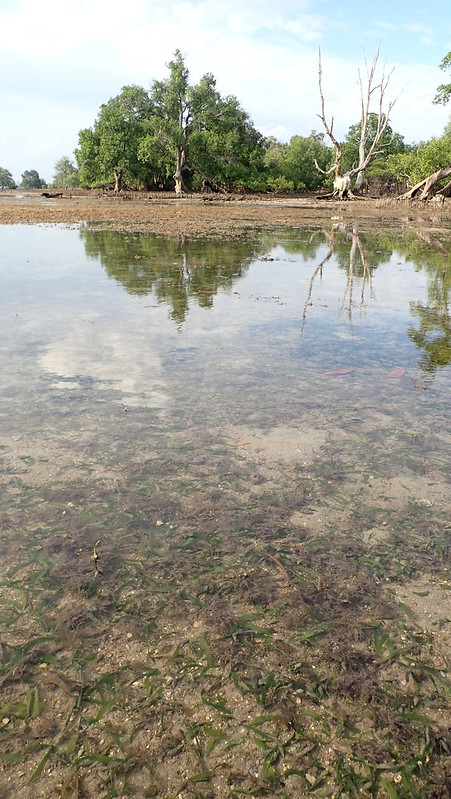
There
is a stream running between the original mangroves on Pulau Semakau (left) and the replanted
mangroves behind the wall (right).
Prof Dan Friess requested a short video to show his students for his class on "Optimism in Coastal Management". He wanted a video in a 'portrait' format - which was particularly challenging to film and process. I probably will never do one again in this format!
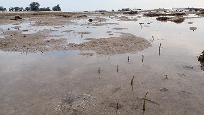
Along and near the stream, there are dense growth of
Spoon seagrass
(small leaf blades) and
Needle seagrass
(narrow as well as broad leaf blades).
Despite the lush dense growths, I didn't see any signs of dugong feeding
trails.
North of the stream, there are also lush growths of seagrasses, mostly
Sickle seagrass.
Further away from the stream, the area which used to be thick with long
Tape seagrass
is bare sand.
Most of the Tape seagrasses were still cropped short. Although I saw a few
clumps with longer leaves near the reef edge.
The seagrasses were mostly fresh and green, although there were some patches
heavily covered in epiphytes. The situation seems similar to the last time I
had a good look at seagrasses here was at our survey in
Apr 2018.
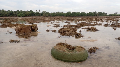
There are not a lot of corals on this shore. And I couldn't get to the reef edge
as it was covered in dense growths of
Sargassum. The corals I did see seemed
mostly alright and I didn't see signs of mass coral bleaching.
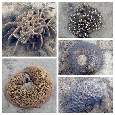
I did see many small healthy colonies of a variety of
hard corals.
There were also some colonies with large dead portions, although the living
portions seemed alright. Some had pale or pinkish portions.
I saw a few small colonies of
Leathery soft corals: not bleaching. A large patch
of
Sea mat zoanthids had small pale portions. I saw many
Giant carpet anemones and
Frilly anemones, none were bleaching.
Horse mussel clams have spread out to a larger area. In
Jan 2020 and
Mar 2019, I saw them in small groups of less than 10, spread apart. Today, there were a
lot more and closer together. Covering an area of about 20m2.
However, there were good growths of seagrasses among the mussels.
There were still many
Fire anemones on the shore. Some other interesting
encounters include several
Eggwhite moon snails. A cluster of three
Gymnodorisnudibranchs that usually eat other nudibranchs including one another. I also saw
many large
Cake sand dollars, and two small
Orange spotted hermit crabs. The rest of the team also saw other interesting animals.
Today, Jianlin came across two horseshoe crabs in mating position. It was a relief to see no abandoned nets or traps on the shore. These can have devastating impact on horseshoe crabs and other animals.. On our trip in
Mar 2019, we came across the bones of a dead sea turtle in an abandoned net.
But Vincent Choo came across this dead shark on the shore. It was not trapped in a net. We are not sure what happened.
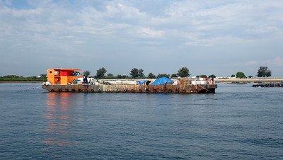
The large barge used by the fish farm seems in better order today than on our
last trip in
Jan 2020, when there were stinking piles of netting there.
On the way to the shore, there was a Large Crude Carrier at the SBM
(floating yellow thing in front of the vessel). Such large vessels can't berth
next to the refineries at Pulau Bukom. So crude oil is pumped through the SBM
via under sea pipes to the petrochemical plants at Pulau Bukom.
Here is a diagram of the SBM Buoy, and undersea pipeline to Bukom (red
and blue). From a
briefing given to the marine community by Shell in 20212 when they replaced part of the undersea pipeline (red).
More about Pulau SemakauIt is NOT true that the construction of the Landfill created the marine
life found on Pulau Semakau. The marine life was there long before the Landfill
was built.
As the existing half of the Landfill was used up, the
Phase 2 of the Landfill was launched. This involved closing the gap of the seawall on the Semakau Landfill, forming
one big pool where incinerated ash will be dumped.
NEA worked to limit the damage to natural shores
during the construction work for this expansion of the landfill.
The
2030 Landuse Plan by the Ministry of National Development released in Jan 2013 shows plans for 'possible future reclamation' (in light
blue surrounded by dotted lines) that may impact the eastern shore of Pulau
Semakau. More about the
possible impact of the 2030 Landuse Plan on our shores.
The Singapore Blue Plan 2018Pulau Semakau and nearby islands
and submerged reefs have been recommended by the Singapore Blue Plan 2018 for
Immediate Conservation Priority.
The Blue Plan recommends the
intertidal and subtidal marine areas of Pulau Semakau and adjacent Pulau Hantu,
and Pulau Jong to be designated Marine Reserve.
The Blue Plan
highlights that Pulau Semakau and its associated patch reefs comprise many
ecosystems: coral reefs, mangrove areas, intertidal sandflats, seagrass meadows,
and coral reefs. The subtidal area of Pulau Jong is larger than the terrestrial
area. Pulau Hantu is a popular dive site has seen increasing interest in the
past decade due to biodiversity awareness. If protection is accorded to these
three islands, zonation plans for use can be implemented to manage tourism and
human impacts.
DOWNLOAD the Plan, SUPPORT the Plan! More on the
Singapore Blue Plan 2018 site.
Photos by others on this tripLoh Kok ShengJianlin Liu