
 |
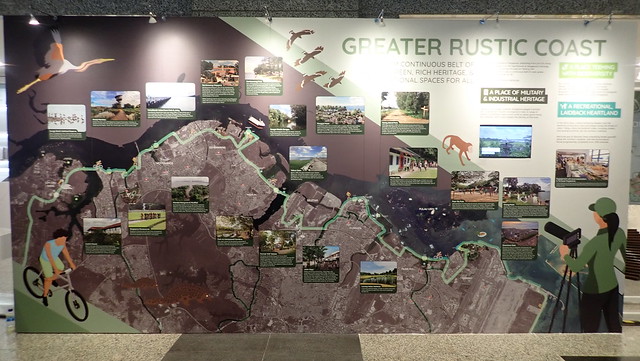
| Illustrative panel of the Greater Rustic Coast at the Draft Master Plan exhibition. |
Agriculture uses removed from Pulau Ubin
In the 2019 Draft Master Plan map, the areas in Ubin previously designated in the 2014 Master Plan for 'Agriculture' (dark green) is now changed to 'Open Space' (olive).

Reclamation profile on Pulau Ubin remains unchanged
Unfortunately, there is no change in the reclamation profile (yellow) over eastern Ubin that covers the whole of the Chek Jawa intertidal area to Ubin Jetty. I noticed that the reclamation profile is divided into three sections. I have no idea what this means. Pulau Sekudu doesn't show up on the map except as a squiggle in the southern outline of the reclamation profile. Which probably means if reclamation goes ahead, Pulau Sekudu will be buried too?!

Under Control plans>Parks, Waterbodies and Public spaces, all of Pulau Ubin is designated a Nature Area, and the western half of Pulau Ketam, although not coloured green.

There are 3 designated Nature Areas on Pulau Tekong, although not coloured green (why not?). These appear to coincide with Beting Bronok, Pulau Unum and the eastern mangrove area on Pulau Tekong. None of Tekong is coloured green.

At the exhibition, this time, they included the whole of Pulau Ubin, In the 2013 Draft Master Plan exhibition, Ubin was chopped in half.
Plan for northern coastline to remain rustic?
This seems to be the implication from the entire panel featuring the area as a "Greater Rustic Coast": "A 50km Continuous Belt of Rustic Green, and Recreational Spaces For All - The northern coastline of Singapore, stretching from Lim Chu Kang to the tip of Changi, is of rich significance to Singapore’s heritage. Creating not just a journey through our history, the Greater Rustic Coast is also a continuous belt of rustic green, and recreational spaces for all."
It's nice to see mangrove activities being promoted, for example at Sungei Khatib Bongsu.

It seems that the mangroves at Pasir Ris Park and boardwalk there are likely to remain.

Pulau Ubin is highlighted as the "home to the Chek Jawa Wetlands, one of Singapore's richest ecosystems".

There are other areas of interest along the northern shores and URA is seeking YOUR feedback on these:
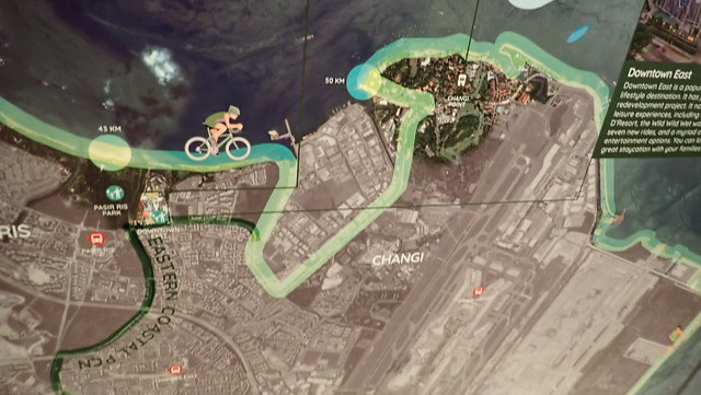
Will there be boardwalks as part of the Round Island Route?
From "Greater Rustic Coast": "As the Round Island Route is progressively completed from 2019 onwards, we invite you on a journey along our rustic northern coastline to explore each of these characteristics."
The Round Island Route skirts close to the shoreline. It is not clear from the diagrams whether these include boardwalks over the shore and other constructions that impact the shores. I am particularly worried about this portion that skirts around the eastern tip of Pasir Ris Park and along the Changi coast.
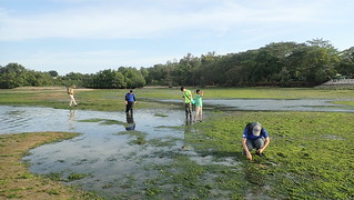 |
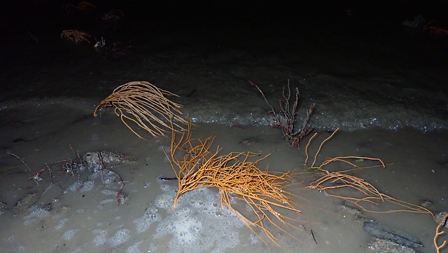
| Seagrass meadows at eastern Pasir Ris Park, with tiny mangrove patch in the background. |
 |
| Yellow arrows point to lines in the water attached to traps. These lines are placed on both sides of the boardwalk. |

Related links
- Coastal boardwalks can do more harm than good - general overview of some unintended outcomes
- Changi Boardwalk: a death trap for wildlife? - about the otter killed in a 'bubu'
- Berlayar Creek Boardwalk is open! with a review of observations of how it was constructed.
- Loving Chek Jawa to death? about NEA spraying of chemicals from the Chek Jawa boardwalk to protect visitors from malaria and how they continue to do this even after correspondence with them about how it impacts the ecosystem
What is the Master Plan about?
My layman understanding is that the Master Plan, done by the URA, outlines the uses of Singapore's land* to "guide Singapore’s development needs over the next 10 to 15 years". Various Ministries and government agencies are responsible for actual details of how the use is applied. The Master Plan seems to be updated every 5 years or so. Here's the full technical explanation of what the Master Plan is about.
*The URA Master Plan does not outline uses of sea areas (except for reclamation profiles). The need for integrated marine spatial planning is covered under Recommendation 1 of the Singapore Blue Plan 2018: "Establish formal management systems for marine environments. A marine spatial planning regime should be established within the integrated urban coastal management framework". With more details in the section on "Coastal and Marine Spatial Planning" under the Chapter on Legislative Support for The Blue Plan 2018
In addition to browsing through the URA 2019 Draft Master Plan website, I highly recommend visiting the URA's exhibition to get a better feel of the Plan.
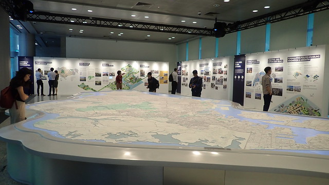 |
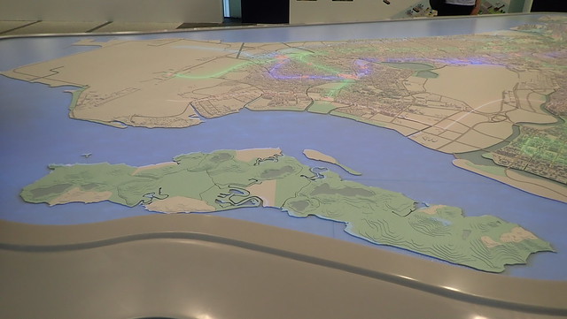
| At the exhibition, in addition to informative panels, there is also a show over the large map of Singapore that effectively illustrates the key aspects of the Plan. |
What can one person do about the Draft Master Plan?
Speak up for what you love!
URA is actively seeking YOUR feedback (that's why a Draft is presented first). Send in your ideas and feedback by 25 Apr 2019.
Don't take our shores for granted!
Visit our shores before they are gone. Join nature activities on our shores. Share what you've seen.
To find our more, check out Celebrating Singapore shores
- Connect with our shores by joining shore activities.
- Respect our shores by learning more.
- Protect our shores by volunteering.
Related links to the 2019 Draft Master Plan
- Climate change in the 2019 Draft Master Plan
- Pulau Ubin and northern shores in the 2019 Draft Master Plan
- Kranji and Mandai shores in the 2019 Draft Master Plan
- Eastern shores in the 2019 Draft Master Plan
- Southern shores in the 2019 Draft Master Plan
