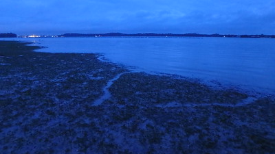
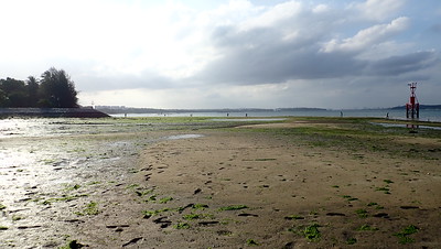
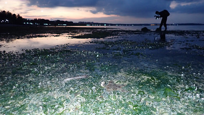
You can find interesting marine life all along this beach which is more than 3km long. And enjoy the tranquility of palm trees swaying in the sea breeze, under wide skies overlooking Pulau Ubin.
This shore is sprinkled with sea stars! You are likely to see Biscuit sea stars both large and small. Sometimes, many huge Eight-armed sea star - bigger than your face! Other kinds include Cake sea stars, some bright orange, others more camouflaged. While many Sand stars usually come out of hiding after sunset: Plain sand stars and Painted sand stars.
Sea cucumbers are also commonly seen. Pink warty sea cucumbers may be common, as well as Garlic bread sea cucumbers, Ball sea cucumbers. Other interesting sea cucumbers include Orange sea cucumber and See-through sea cucumber and synaptid sea cucumbers.
The shore here is soft and silty, in some parts so soft you can easily sink up to your knees! This is perfect for burrowing cnidarians like cerianthids and Flowery sea pens. Sometimes, there are also many large Swimming anemones, which don't burrow and can actually swim. You are also likely to encounter interesting sea slugs among the seaweeds and seagrasses. The large Hairy sea hare is sometimes so abundant that you have to watch your step closely to avoid stepping on them. Nudibranchs both large and tiny are sometimes also seen!If you look carefully, you might spot dugong feeding trails! Seagrass is the dugong's main food. So not surprisingly, it is also sometimes called the Sea Cow! It pulls out a mouthful of seagrasses with its thick lips, shakes it to get rid of the sand and then swallows. Dugong feeding trails are formed when dugongs chomp up seagrasses including their roots, leaving a shallow meandering furrow of about equal width and depth.
Guided intertidal walks at Pasir Ris
Ideally, it's best to visit a shore with an experienced and trained guide. Why?
See more! Experienced guides are familiar with the terrain and seasons of the shores. They can show you more during the short window of low tide. They can also tell you more about what you see so you can learn more.

Minimise your impact: Every inch of the shores are alive with small animals and growing plants. An experienced guide will help you see more and yet minimise the impact of your visit.
Have a great time! Guides are eager to ensure you have an enjoyable visit. Whether you are just there to see what's so special about the shores, or if you need more details for a project or have a special area of interest. Do tell your guide, who will gladly try to help you.
Consider joining walks by Young Nautilus who have pre-planned visits and will also gladly organise trips to fit your schedule. More about their public programmes.
If you do want to visit on your own, here's some issues you should take into consideration ...
When is the best time to visit our shores?
Singapore waters tend to be murky and cloudy (like 'kopi susu') because of the high sedimentation. Thus, if you go at high tide, you can't see much. However, just because you can't see something, doesn't mean there is nothing there.
The rich shorelife is more easily seen at low tide. The lower the tide, the larger the expanse of shore exposed and a wider variety of shorelife can be seen.
It's best to visit with the outgoing tide. The water is clearer as the tide falls, and in areas where a calm shallow lagoon forms at low tide, behind a sand bar. The water tends to get murky as the tide turns and water rises and rushes in.
Singapore has two low tides and two high tides a day. The height of the tide is not the same every day. High and low tides do not happen at the same time every day, and the highest and lowest tide level change every day. Tides suitable for a visit to the shore do not necessarily occur on a weekend. Suitable tides usually fall before sunrise and after sunset. There are few suitable tides during daylight hours.
Here's more about the tides: what causes them, and about Singapore's tides.
How low should the tide be to see something at Pasir Ris beach?
Some parts of Pasir Ris beach can be explore even at a moderately low tide. East of the mouth of Sungei Tampines, there is a small cluster of mangrove trees on sandy shores that can be explored even at moderately low tides of 0.6m for Changi tide tables. Here, you can spot tiny fiddler crabs, sand bubbler crabs. Small areas in front of the seawalls may also be exposed at this tide height.
But the lower the tide, the more of the shore is exposed! Large areas of shore at the eastern most end of Pasir Ris is exposed even at 0.4m for Changi tide tables. This shore is off Carpark A and Aloha Resort (Loyang).
The ideal tide for intertidal exploration is 0.2m for Changi tide tables. Here is what is exposed at 0.2m on the shore opposite carpark E.
Such low spring tides tend to occur near or after sunset at this time of the year. So be prepared with a small torch.
Where to find tide information?
The marinas based at Changi provide on their website, the hour-by-hour predicted tides for Changi. Links to these and more about Singapore's tides here.
Safety on the shore!
Comply with all prevailing COVID regulations. Visit the NParks SafeDistance website to check on the current crowding at the location, and for the latest COVID regulations.
SOFT MUD! Many parts of Pasir Ris shore have very soft mud where you can sink up to your knees. When this happens, the only way you can get out is to walk out on your knees (you distribute your weight over your folded legs and thus stop sinking). Obviously, you will get very muddy in the process. So watch your step and do not move on once you start sinking to your ankles.
Lighting and rain: Immediately evacuate to one of the park shelters at the first signs of the weather turning bad. Lightning can occur without rain. Get the latest weather situation here: radar readings updated every 10 mins.
Don't touch! All animals defend themselves from predators or they will be eaten up and soon become extinct. Some of these animal defences can cause humans irritation, pain or even worse injuries and death. As with any nature walk, it is important to respect the wildlife: do not touch animals, don't poke them, leave them alone. Cover all skin that can be exposed to the water; wear covered shoes. Do not walk on bare feet. Closely supervise young children who may accidentally touch animals, then rub their eyes or put fingers into the mouth.
At the same time, our visit also affects the safety of the shores. Our shores are fragile. Many small sea creatures live in the sand and mud. These are killed when we step on them, no matter how gently we walk. These small sea creatures form the base of the entire food chain on our shores. Seagrass have delicate roots and take a long time to recover when trampled on.
If we are not careful, we can damage the shore when we visit. Be gentle. Watch your step. Avoid wading into deeper murky waters as you won't be able to see what you are stepping on. Don't poke animals or dig them up or bring them home. Take only photos.
Sharing your photos is one way to give back for the damage you cause to the shore. No matter how careful you are, you will cause some damage.
MORE tips for safety on our shores and FAQs about shore visits.
Explore Pasir Ris marine life at any tide!
There is a boardwalk through Pasir Ris mangroves that is open 24/7 and allows you to get close to marine life at any tide. From the boardwalk, you can see all kinds of animals that you cannot see on the intertidal: giant mudskippers, large tree climbing crabs, mangrove snakes, owls, monitor lizards. In the high waters, sometimes jellyfishes and even otters!
More about the Pasir Ris mangrove boardwalk: how to visit, what to see and do.
What is the future of Pasir Ris shores?
Pasir Ris shores are precious because they may be reclaimed in the 2013 landuse plan by the Ministry of National Development released in response to 2013 Population White Paper.
The blue outlined areas are "Possible Future Reclamation". The plans include a road link (black line) from the mainland jumping off at Punggol, crossing to Pulau Ubin through Chek Jawa to jump off to Pulau Tekong before circling back to the mainland on Changi East. Proposed reclamation (in yellow) will bury Pasir Ris shores, Pulau Sekudu and Chek Jawa as well as the Changi Beach shores from Carpark 6 to Carpark 7.
Links to more
Latest about Pasir Ris Park on the NParks website with a map of the park and how to get there.
More about what I've seen at all the Pasir Ris shores in surveys done for more than ten years.


